
Shandul'Ki: Regional Map
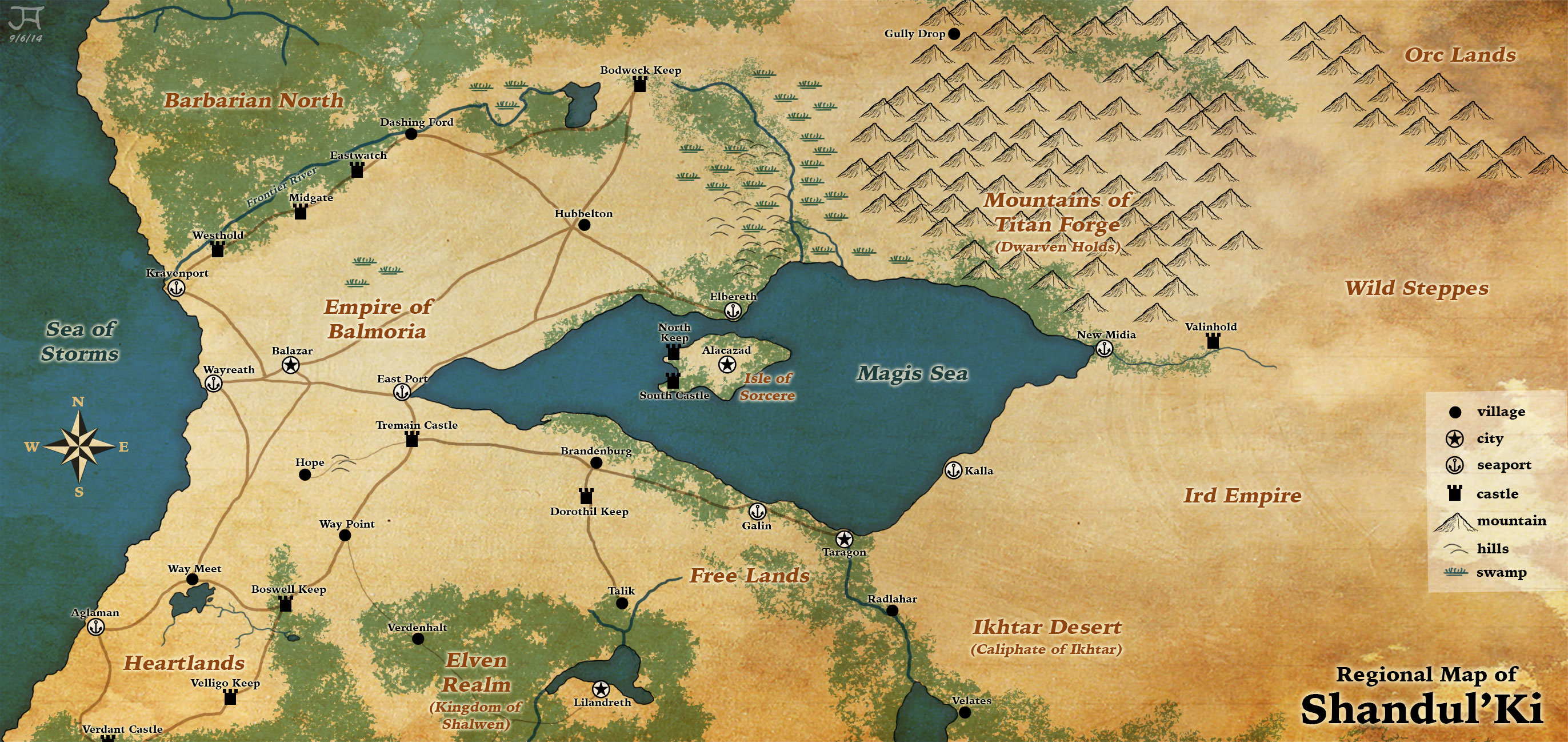
I just started playing Pathfinder in the past couple of years. My first DM ran a homebrew campaign setting he called Shandul’Ki. At our first session, he showed us a regional map of Shandul’Ki that he had created with a map generation program of some kind, but without any of the political boundaries clearly delineated. I decided to beautify this map while the group was on a two week hiatus. Our DM also gave us a list of the various regions of his world with extensive descriptions, so I tried to fill in the blanks where some regions of his map were unidentified. I wanted this map to look like water-color painted on parchment. The roads and towns have been drawn from the perspective of the Balmorian Empire as the center of civilization. The Balmorians know of the Ird Empire and the Ikhtar Caliphate to the far east, but they do not have operable knowledge of their roadways or caravan routes. Our campaign is centered around political upheaval within the Balmorian Empire, so this is the sort of map that the PCs would expect to be familiar with. This map was created entirely in Photoshop. I used the mountain ink stamp image from Ravenfield’s PS brushes. My “forested” areas were created with a customized PS scatter brush that blends a leaf shape with an abstract blob to create the sponge-like water-color pattern. This was my first attempt at doing a regional-scale map for RPG purposes. |